San Andreas Fault, Part 2: Carrizo
Plain, Soda Lake & Bitter Creek
By Dan Robinson of
stormhighway.com
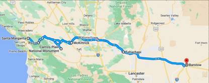
Getting
oriented… coming in on CA-58 (a Blue Star Memorial Hwy) from either the west
and Santa Margarita (CA-101) or from the east and McKittrick (CA-33)

Below is Part 2 of
Dan Robinson’s San Andreas Fault ‘trip’
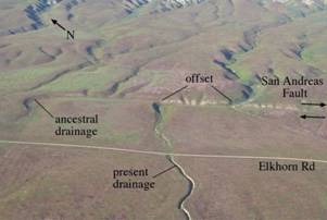
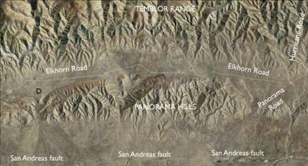
Start at Highway 58 and 7 Mile Rd. Our guide will take
you down Elkhorn Rd., 0.31 miles from the start, but if you continue on 7 Mile
Rd another 0.85 miles from Hwy.58 you will find the San Andreas fault a little
east of a small rise on your right, just before a slight bend in the road. At
the rise, look north to see an east-facing fault scarp adjacent to the road,
and further away a west-facing scarp. Look to the south and you will see a
right-lateral offset on the small west sloping drainage channel. To continue,
return to Elkhorn Rd.
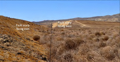
View northward from 7 Mile Road showing east- west facing
fault scarps along the trace of the SAF
What is a shutter
ridge? Below is one near Maqin County, Qinghai Province, China
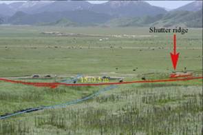
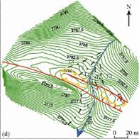
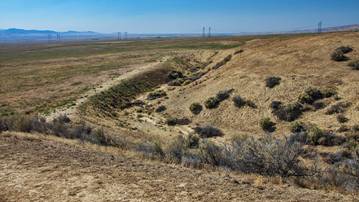
A strike-slip fault
shutter ridge (see Wallace Creek below) blocks and offsets drainage.
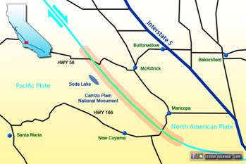
*Only Soda Lake Road
remains open all year long. Check with the visitors center but in general…
Don’t visit here if
there’s even a chance of wet & slick roads! You’ll get stranded!
If it’s raining… try
a Virtual Visit/Tour!