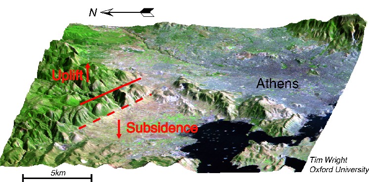
The red lines denotes the
two possible surface traces of the fault ruptured in the 7th September
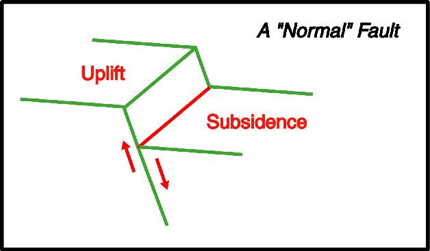
1999 Athens earthquake. The fault will have moved by about 50cm during
the earthquake, uplifting the mountains to the north and causing the plain
to the south to subside. Initially, the dashed red line seemed the likely
candidate for the fault because it has the stronger topographic expression.
However, field observations and damage reports suggest that the solid red
line is probably the fault responsible for the earthquake.
Click
for high resolution version of image

ADDITIONAL INFORMATION
Click
for map of aftershock locations and damage zone
FIELD
REPORT by Prof. Spyros Pavlides, Thessaloniki University
Imagery
and maps from A Ganas, S Pavlides, and G Papadopoulos
NEW:
Field
Photographs
NEW:
Focal
Mechanism
For further information contact Tim Wright
Last updated 20/9/1999
