Scientific Images of the 1995 Hyogoken-Nanbu
Earthquake
collected about 25 Jan. 1995 from Internet sources
Tectonic Setting of the

Map of
The above map was prepared by Grant Marshall, USGS.

Harvard's CMT mechanism with a location map.
Take a look at the broadband
record from Pasadena posted by the California Institute of Technology. This is
a link to the original archive.
Seismicity
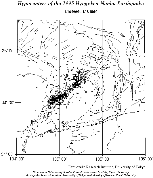
Map of located aftershocks and other earthquakes between Jan.
16 and 18, compiled by the Earthquake Research Institute,

Map of located aftershocks and other earthquakes between Jan.
21 and 23, compiled by the Earthquake Research Institute,
Click here
for a printable postscript map for Jan 18-19, and here
for a printable postscript map for Jan 19-21.
Strong Motion Records
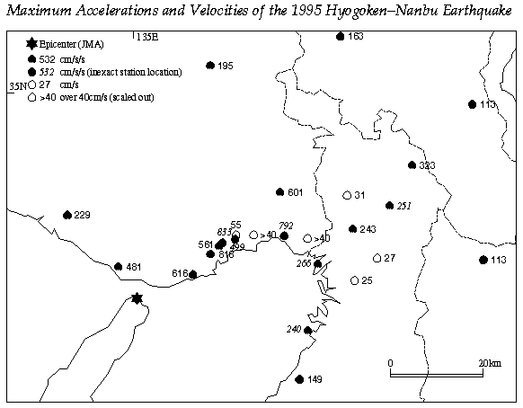
Map of maximum ground accelerations and velocities, compiled
by the Earthquake Research Institute,
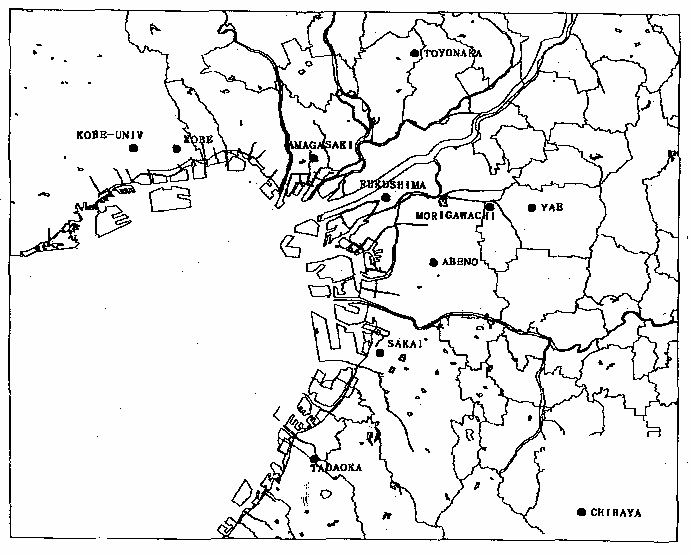
Location map of strong-motion records compiled by

This site shows persistent motion.

This site shows sharp, high ground-velocity motion.